

Nationwide Study Reveals How Urban Compactness Affects Carbon Emissions in Japan



The effects of urban scale, density, aggregation, and connectivity on carbon emissions vary across regions and change beyond key thresholds, offering new guidance for region-specific low-carbon spatial planning
Key findings
- Nationwide evidence from urban-form and carbon-emission data for all 47 prefectures, 2005–2020
- More compact does not always mean lower carbon: the effects of urban size, density, and connectivity can change beyond certain levels.
- Dominant drivers differ between dense metropolitan and lower-density regions, highlighting the limits of a uniform densification strategy
- Predicted emissions rise sharply beyond approximately 60,000 ha of built-up land
Research overview
A research team led by doctoral students Lei Li and Shujie Sun and Professor Xuepeng Qian of the Graduate School of Global Environmental Studies at Sophia University, together with Zijie Pang of Xinjiang University, Professor Liang Dong of City University of Hong Kong, and Professor Ji Han of Ritsumeikan Asia Pacific University, conducted a nationwide analysis of the relationship between urban morphology and carbon emissions in Japan.
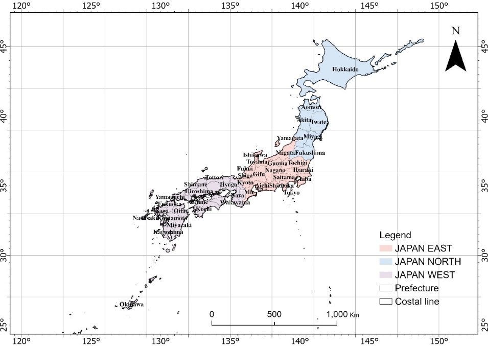
Building on the ISTNR framework previously published by the team in 2025, the study integrated satellite imagery from 2005, 2010, 2015, and 2020 with prefecture-level CO₂ emissions and population data for all 47 prefectures.
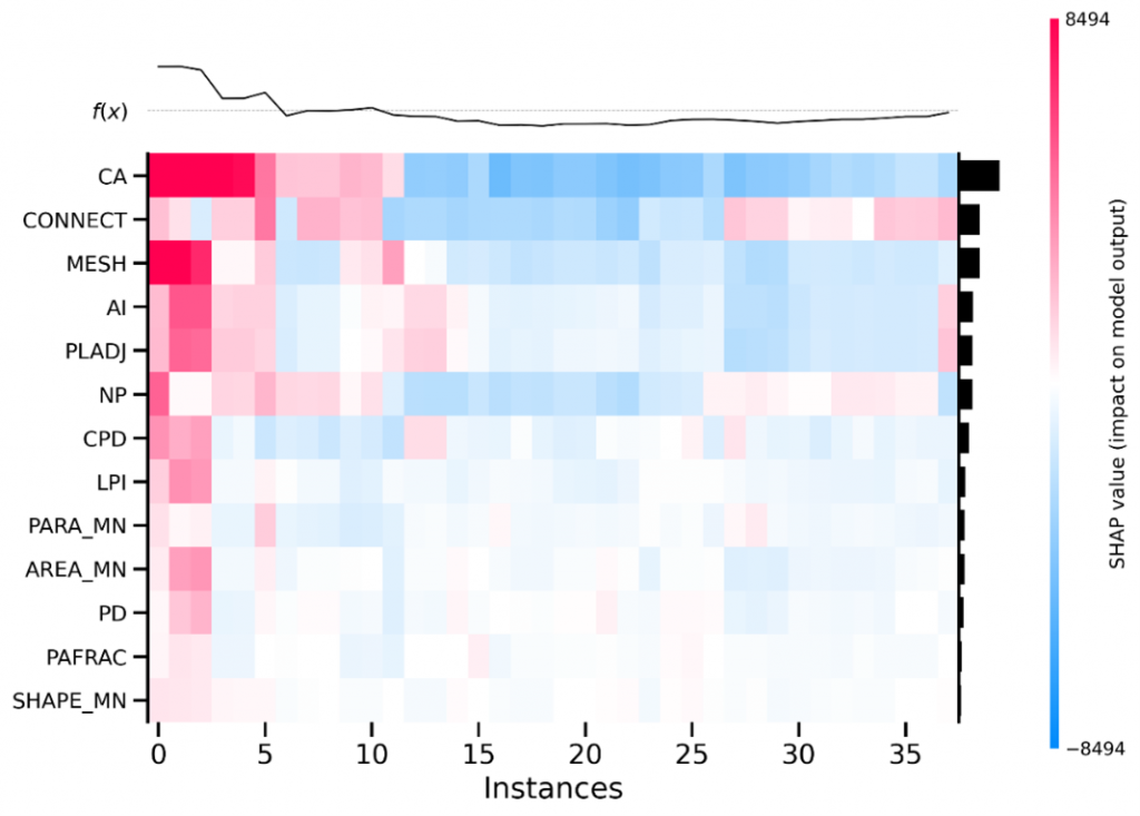
Geographically weighted regression (GWR), Random Forest (RF), and SHAP were combined to examine regional variation, nonlinear responses, and interactions among urban-form indicators.
The results show that compactness-related factors were particularly influential in dense metropolitan areas such as Tokyo and Osaka, whereas shape complexity and fragmentation were more influential in lower-density regions such as Hokkaido. For the analyzed prefecture-level data, the model identified a sharp increase in predicted emissions beyond approximately 60,000 hectares of built-up land. Adjacent urban-land shares of 55–70% and population densities of approximately 4,000–7,000 persons/km² emerged as key nonlinear response ranges associated with stronger mitigation potential.
This study shows that a more compact city is not always a lower-carbon city. In high-density cities, improving internal urban structure and public transport is especially important, while in lower-density regions, reducing excessive urban dispersion and fragmentation is more critical.
These findings highlight the need for urban planning strategies tailored to regional conditions. The study was published in Cities, Volume 171 (April 2026).
Paper and authors
- Journal
Cities(Volume 171, Article 106831)
- Article title
Uncovering nonlinear threshold effects of urban morphology on carbon emissions: Toward optimal low-carbon urban spatial planning
- Publication date
2026年4月
- Authors
Lei Li, Shujie Sun, Zijie Pang, Liang Dong, Ji Han, Xuepeng Qian
Research background
This study forms part of a broader series of data-driven studies on urban morphology and carbon emissions. The team published the methodological ISTNR study in Sustainable Cities and Society (Volume 125, Article 106381) in 2025 and presented the approach at the 2025 NEW Environmental Exhibition in Tokyo as a new spatiotemporal nonlinear regression model for optimizing low-carbon urban spatial planning. The present study extends that foundation to all 47 prefectures using 2005–2020 data.
Urban spatial structure affects emissions through travel distance, land-use efficiency, and energy demand. Although compact development can support public transport and shorter trips, greater compactness does not always mean lower carbon emissions. Previous single-city, single-scale, or linear studies have often been unable to capture interacting indicators and region-specific turning points.
In many parts of Japan facing population decline, aging, and urban shrinkage, the Compact City approach has become an important strategy for maintaining urban services and improving spatial efficiency. Japan provides a distinctive setting because urbanization is shifting from outward expansion toward internal spatial restructuring. The team extracted built-up land from satellite imagery and quantified six dimensions of urban morphology: scale, density, fragmentation, shape complexity, aggregation, and connectivity.
Urban scale and population density were particularly influential in eastern metropolitan areas; in western Japan, urban scale remained important while connectivity-related factors became increasingly influential; and in northern Japan, shape complexity and small-scale spatial inefficiencies played a greater role. These contrasts highlight the limits of a uniform nationwide densification strategy.
Within the analyzed data, predicted emissions rose sharply beyond approximately 60,000 hectares of built-up land and strengthened at higher aggregation levels. Population densities of approximately 4,000–7,000 persons/km² and adjacent urban-land shares of 55–70% appeared as key nonlinear response ranges more compatible with mitigation. When both urban area and connectivity were high, their interaction further amplified modeled emissions, underscoring the need to coordinate multiple indicators rather than treat any single value as a universal policy threshold.
Future directions
The findings show that low-carbon planning should not pursue uniform densification or treat a single modeled threshold as a universal standard. Strategies should reflect regional conditions and coordinated response ranges across multiple urban-form indicators.
Future research will test ISTNR in other countries and cities and examine coordination across administrative boundaries. Integrating public transport, functional zoning, green infrastructure, and ecological measures could translate these findings into more effective low-carbon urban policy.
Funding
This work was supported by the Japan Science and Technology Agency (JST) SPRING program (Grant No. JPMJSP2169).
Inquiries about this research
Graduate School of Global Environmental Studies, Sophia University
Professor Xuepeng Qian (qianxp@sophia.ac.jp)
Press contact
Office of Public Relations, Sophia University (sophiapr-co@sophia.ac.jp)